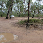
Jack Evans track to Erskine Creek


2 hrs

241 m
Experienced only
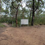


(0km) End of Nepean Lookout Fire Trail → Erskine Lookout

320 m
8 mins
1m
-29m
Moderate track
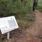
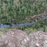
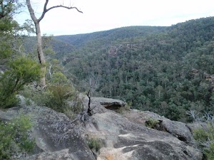
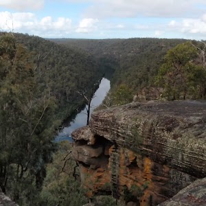
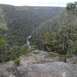
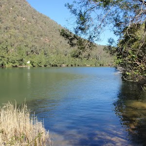
Erskine Lookout
(0.32km) Erskine Lookout → Int of Jack Evans and the lower Erskine tracks
850 m
31 mins
28m
-172m
Hard track
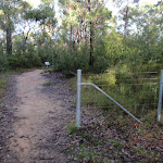
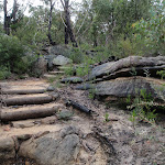
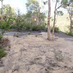
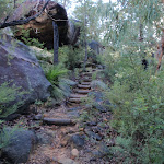
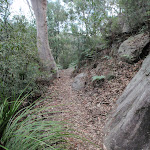
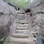
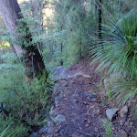
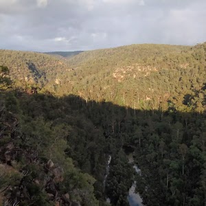
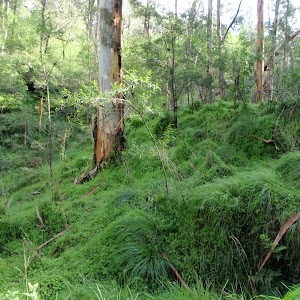
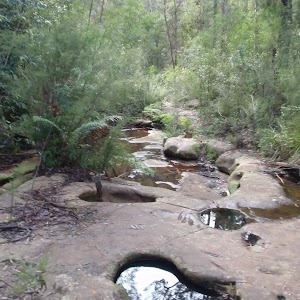
Continue straight: From the intersection this walk follows the wider bush track down the hill to the saddle. On the other side of the saddle this walk heads down a series of timber steps. At the bottom of the steps the track winds through the grass trees. Before seeing the creek the track passes a large gum to come to an intersection with a faint bush track on the right (and a wider track to the left).
(1.18km) Int of Jack Evans and the lower Erskine tracks → Eastern side of natural dam wall
180 m
7 mins
30m
-17m
Experienced only
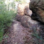
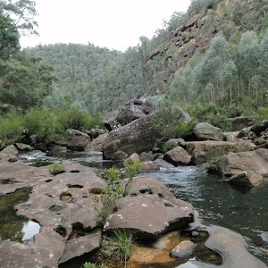
Veer left: From the water depth indicators this walk follows the creek down stream keeping Erskine Creek on the right. The faint bush track soon leads to the visible series of large boulders forming a natural dam wall. At the end of this side trip, retrace your steps back to the main walk then Turn left.
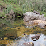
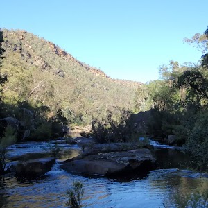
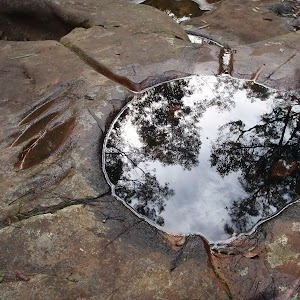
Natural dam pool

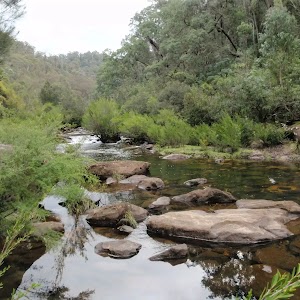
(1.18km) Int of Jack Evans and the lower Erskine tracks → Int of Jack Evans Track and Erskine Creek
100 m
2 mins
5m
-6m
Experienced only
Maps for the Jack Evans track to Erskine Creek walk
You can download the PDF for this walk to print a map.These maps below cover the walk and the wider area around the walk, they are worth carrying for safety reasons.
| Penrith | 1:25 000 Map Series | 90303N PENRITH | NSW-90303N |
| Penrith | 1:100 000 Map Series | 9030 PENRITH | 9030 |
Cross sectional view of the Jack Evans track to Erskine Creek bushwalking track

Analysis and summary of the altitude variation on the Jack Evans track to Erskine Creek

Overview of this walks grade – based on the AS 2156.1 – 2001
Under this standard, a walk is graded based on the most difficult section of the walk.
| Length | 2.6 km | ||
| Time | 2 hrs | ||
| . | |||
| Grade 5/6 Experienced only |
AS 2156.1 | Gradient | Very steep (4/6) |
| Quality of track | Formed track, with some branches and other obstacles (3/6) | ||
| Signs | No directional signs (5/6) | ||
| Experience Required | Moderate level of bushwalking experience recommended (4/6) | ||
| Weather | Storms may impact on navigation and safety (3/6) | ||
| Infrastructure | Limited facilities (such as cliffs not fenced, significant creeks not bridged) (4/6) |
Some more details of this walks Grading
Here is a bit more details explaining grading looking at sections of the walk
Gradient
Around 850m of this walk is very steep, whilst the remaining 430m has short steep hills.
Quality of track
This whole walk, 1.3km follows a formed track, with some branches and other obstacles.
Signs
850m of this walk has minimal directional signs and another 320m has directional signs at most intersection. The remaining (100m) Has no directional signs.
Experience Required
Around 970m of this walk requires some bushwalking experience, whilst the remaining 310m requires a leader a with moderate level of bushwalking experience.
weather
Around 1.2km of this walk is not usually affected by severe weather events (that would unexpectedly impact safety and navigation), whilst the remaining 100m is affected by storms that may impact your navigation and safety.
Infrastructure
Around 970m of this walk has limited facilities (such as not all cliffs fenced), whilst the remaining 310m has limited facilities (such as cliffs not fenced, significant creeks not bridged).
Similar walks
648 m Return
20 mins
Moderate track

7.1 km Circuit
4 hrs 30 mins
Very experienced only

10.3 km Circuit
2 Days
Very experienced only

Other Nearby walks
1.3 km Return
30 mins
Moderate track

466 m Return
15 mins
Moderate track

2 km Return
1 Hr
Experienced only

6 km Return
4 hrs
Very experienced only

2.8 km Return
3 hrs
Very experienced only

1.6 km Return
45 mins
Moderate track

18.1 km One way
7 hrs
Hard track

4.3 km One way
1 hr 45 mins
Experienced only

2.8 km Circuit
1 hr 15 mins
Hard track

4.1 km Circuit
2 hrs
Moderate track

1 km Return
30 mins
Moderate track

512 m Return
30 mins
Hard track

Plan your trip to and from the walk here
The Jack Evans track to Erskine Creek walk starts and ends at the End of Nepean Lookout Fire Trail (gps: -33.840333, 150.58145)Your main transport option to End of Nepean Lookout Fire Trail is by;
(get details)


Short URL = http://wild.tl/jettec
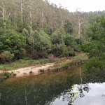
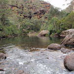
Gallery images
There are other downloads I am still working on.
You will probably need to login to access these — still all free.
* KML (google earth file)
* GPX (GPS file)
Special Maps/ brochures
* A3 topo maps
* PDF with Lands Topo map base
* PDF with arial image (and map overlay)
I wanted to get the main site live first, this extra stuff will come in time.
Happy walking
Matt 🙂
Comments